During the very first leg — the kayaking leg! — of this year’s Spring Fury adventure race, I noticed some awesome flowers as I was getting out of my kayak to go punch a checkpoint some yards inland. Amid the lake reeds, standard spring wetland fare such as skunk cabbage and May apples, there were a few irises. Irises! My favorite flower. Here’s why: Danielle’s and my birthdays are in late spring/early summer, and our anniversary is in mid-May. Prime iris season, as a result of which we associate our anniversary with irises. (We are also big fans of van Gogh, so it helps, too.)
 So here were these awesome, beautiful, slightly smaller and mainly lone specimens of my favorite flower. Even though I was in the woods, the “woods” was pretty darned close to dense habitation, and I wondered whether irises were native to Michigan or whether these were just some rogue feral flowers that had escaped people’s yards.
Well, the answer is, neither. This wasn’t your garden variety (pun intended) iris. It was the Dwarf Lake Iris (Iris lacustris), a beautiful variant that grows nowhere else but in the Great Lakes region and is, in fact, the Michigan state flower. Whaddaya know!
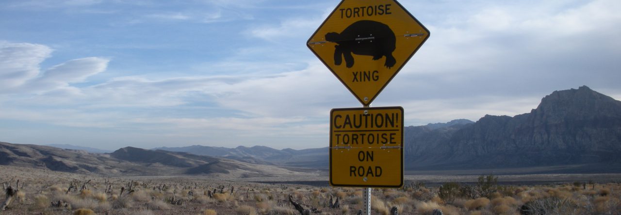
Anyway, it was a nice delight along the grueling adventure race. Other funky surprising delights included the biggest damned turtle I’ve ever seen, smack in the middle of the road. Beyond that, it was a typical Infiterra Sports -organized event: pretty demanding, perfectly managed, and ultimately awesome fun.
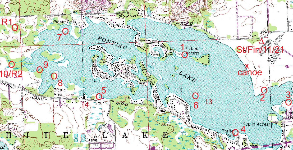 |
| This section of the race map includes the 5.5-mile paddling section. |
Logistical summary: This was a ten-hour race, meaning you’d better finish in ten or you’d go unranked. The disciplines were going to be, as usual, paddling — canoes for teams of two, kayaks for solo racers — and mountain biking. This was an adventure race, after all, so all we knew in advance was that there’d be between five and ten miles of paddling, about twenty miles of biking, and between five and twelve miles of trekking, all depending on “route selection.” There’s no course in adventure racing. Or there is no marked course. You get a map, with checkpoints on it, and you’ll figure out how to get to those places. You use you compass to do it if necessary.
It turned out paddling was first, about five and a half miles of it, mostly on Pontiac Lake but with a brief jaunt up the Huron River, which wasn’t much of a river at that point: two kayaks had a hard time passing one another. As often in adventure races, the order in which one attempts the checkpoints is up to the racer. As the map above suggests, either a clockwise or counter-clockwise plan was the obvious thing to do. I, like most people, went counter-clockwise: 1, 7, 10, 9, 8, 5, 6, 4, 3, 2. Paddling on a lake is straightforward; the wind, the chop, and the rain were complications. Also, we learned during race briefing that portages were banned — a disqualifiable offense — but that there would be a waterway connection through the peninsula between 5 and 6 that the map doesn’t indicate, and that it would be OK. The only caveat, we were told, was that it was reeeaaallly low and that if we went into the drink, portage still wouldn’t be allowed.
In the event, I made it. Kayaks are way lower than canoes, but in a kayak, there is nowhere you can duck. I leaned back as much as I could, and I got to watch the concrete roof of the culvert pass by about an inch and a half above my nose. (Fine, I have a big nose. Still, it was tight!)
Next up was a little bit of bushwacking orienteering to hike to our bikes about four miles away. This was along the Huron. I had suspected that we’d be paddling this section to the bike drop, but had wondered when I studied the satellite images about the narrowness of the mighty Huron up there. Narrow it was, and in fact this was a mere few miles from the source of the Huron in the Indian Spring swamps. The trekking revealed this would not have been navigable. Heck, this was no river. In the course of a few miles, I waded it, and in it, several times, and crossed it on fallen logs a few more. You wouldn’t call the Huron mighty even when it’s an actual river, and now we were talking about a creek.
The race directors had warned in the pre-race briefing that this trekking might be hairy, but it was quite manageable. Yes, there was sinking into the mud up to your hips, and there was your typical wet and thorny Michigan marsh, but all of the checkpoints were manageable. Not totally easy, mind you, but nothing you couldn’t do if you thought about it.
Next up was biking. I suck at biking, and generally adventure races are won on good biking. But I did fine. The first eleven miles were mainly along dirt roads, with occasional checkpoints to make us pay attention to route choice, the distance traveled, and other features.Then we had to ride the ten miles of the Pontiac Lake Single Track trail. That was a fun trail. I had suspected we’d ride it and therefore had read up on it. Online reviews claimed it would be like the Potawatomi Trail nearer to us in Pinckney, but I found it somewhat easier. Still technical at times, and definitely with some good hills, but nothing terrible. In fact, pretty damned fun! I had also read the warnings about poison ivy, and indeed it was plentiful. Some kind soul had spray painted the poison ivy along the bike trail orange, and let’s just say at times you felt you were riding in urban graffiti and not in the woods. The weather, which had started cold and rainy — my pants got soaked five minutes into the kayaking — had warmed up, and I had had a momentary regret about wearing long pants. No more! Both my legs would have gotten a thorough poison ivy treatment without my pants.
The final component of the race was a very long trekking section. Eighteen checkpoints in all, spread over about a thousand acres. My legs had worked well on the biking section, but there had been moments of cramping, and I knew I would not be able to run most of this section, even though it was clear there would be lots of trails to take shortcuts on. So I aimed at getting about nine or ten checkpoints before making sure I’d make the cutoff.
I was pretty pleased with my orienteering, for the most part. The map was great, a 1:15,000 orienteering map with incredible detail. (Unfortunately, no digital version may be shared.) Combining my reading of the terrain, actually taking a compass bearing a few times, and having a pretty good pace count for distance, I found most of the checkpoints I went for quickly. This hasn’t always been the case! One checkpoint seemed to have been misplaced (it was), and it cost me some time, but those of us who plausibly found the spot got the credit.
So the orienteering was mainly good. The biggest problem for me was that I have grown old. Last summer, I got glasses, and while I am totally functional without, reading an extremely detailed 1:15,000 map is not easy. But worry not, dear reader: I have an appointment for contact fitting. I always wear eye protection throughout an adventure race, but instead of getting prescription sunglasses and prescription protective glasses, I’ll just get contacts. Next time, watch me blow away the competition.
Not. Overall, I was quite pleased with what I did. In Infiterra Sports events, the number of checkpoints is your primary score: nobody who finds fewer ever beats you, however faster they might be. In this race, there were lots of optional checkpoints early on, but everybody competitive found them pretty easily, so it came down to the final orienteering section. Basically, the number of checkpoints you got on it determined your rank. So it wasn’t a biker’s race! I was impressed that quite a few teams “cleared” the entire course. That is, they got all the checkpoints. They are national caliber, so I’m not depressed. I am, in some ways, more surprised by the fact I beat some formidable folks. My overall position was sixteenth out fourty-four teams that started and thirty-two that finished. I was the fourth solo racer. One of the solos who beat me was a woman, which I report not with chagrin, but with happiness: adventure racing might slowly become one of those sports where the disgustingly sexist phrase “getting chicked” is something to be proud of. I am, anyway.
In adventure racing, mistakes are par for the course. Anybody whose game plan goes out the window with the first mistake had better not try this sport. Everyone makes mistakes. They come in many ways. There are bad route choices, there are misreadings of map, there are misreadings of the terrain, there are forgettings (the amount of things you have to keep track of is amazing), there are mis-rememberings (I made one this time, mis-remembering a turn I had planned on the biking section), there are mishaps, there is tiredness, cramps, bonking, dehydration, bugs, nettles, cold, wetness, heat, and, if you’re in a team, fights with others. If you’re not, there is still the risk of second-guessing yourself and following someone else, who might know exactly what they are doing, or not.
Given all those possibilities, I’m completely happy that things went as well as they did and that I made as few mistakes as I did.
This post is pretty short on photos. I didn’t have time to take any myself, and the race organizers haven’t been able to post any yet. So words will have to suffice.
